
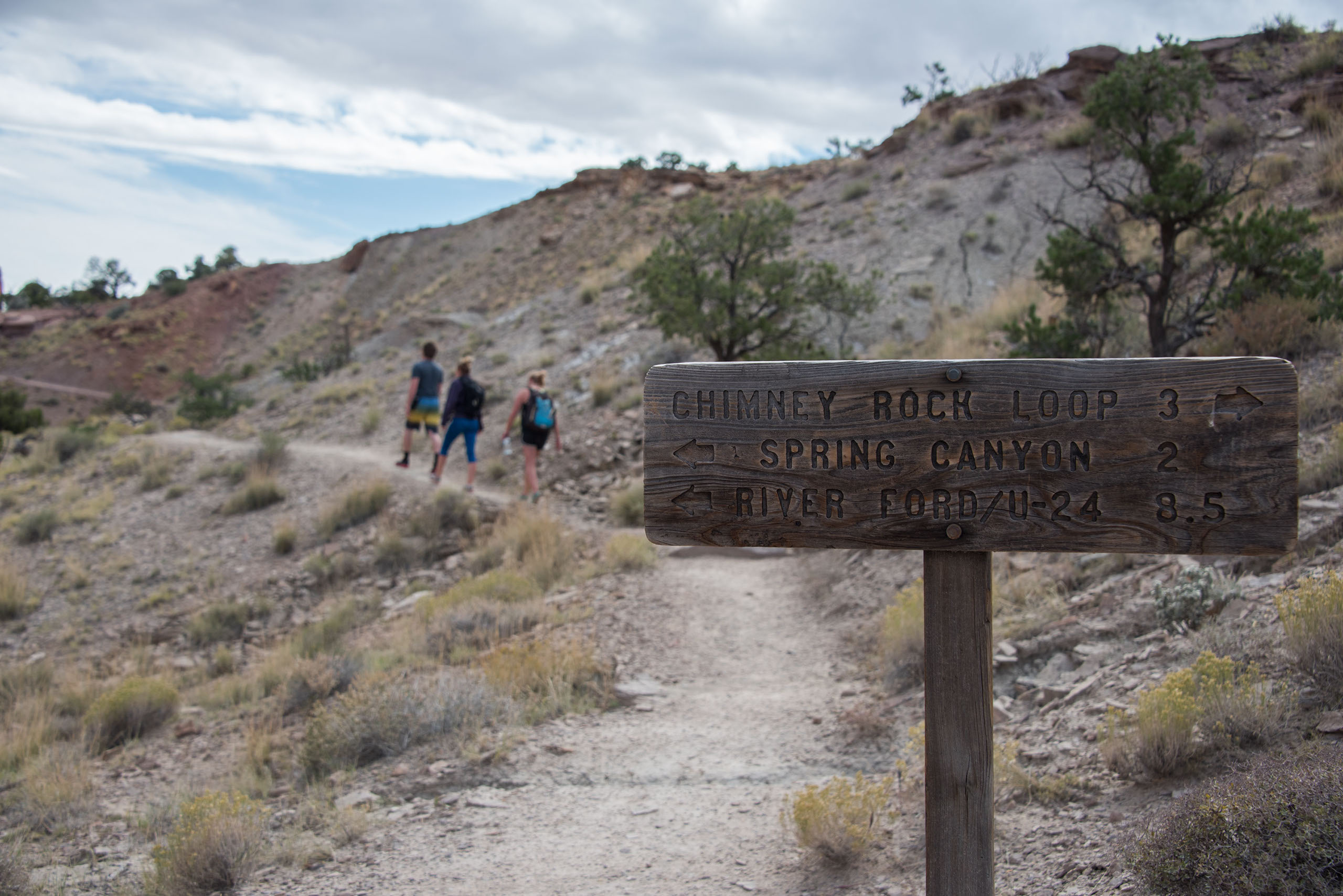
The most effective way to complete this hike would be to take two cars, so you can hike straight through the lower portion of the canyon. Once you’re in Capitol Reef National Park, pass the Chimney Rock trailhead, and drive to mile marker 83 and park in the pull off area. This is where you will end the hike. Once your group is all in the same car, drive back up the road to the Chimney Rock trailhead. This is where you will start your hike. Follow the signs to ensure you are making your way to Spring Canyon.
Chimney Rock Canyon Trail guides you up switchbacks, eventually leading you to a fork. The right fork continues to increase in elevation, leading up to Chimney Rock, and the left descends into Chimney Rock Canyon. To reach Lower Spring Canyon, take the left fork and follow Chimney Rock Canyon for about 1.5 miles. This eventually leads you into Spring Canyon.
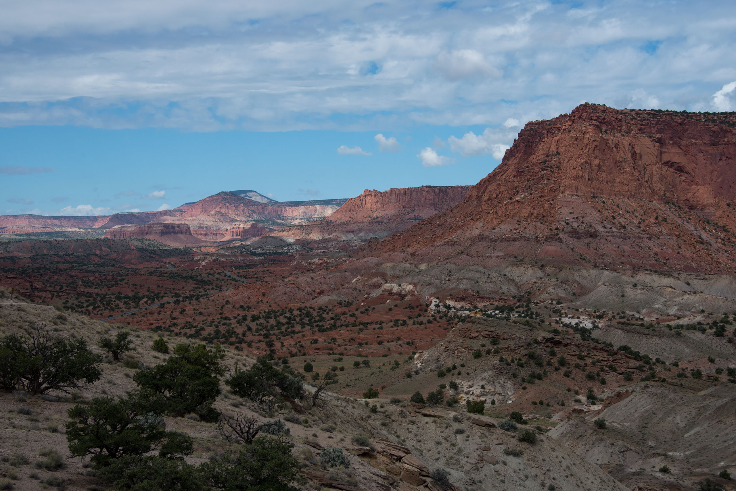
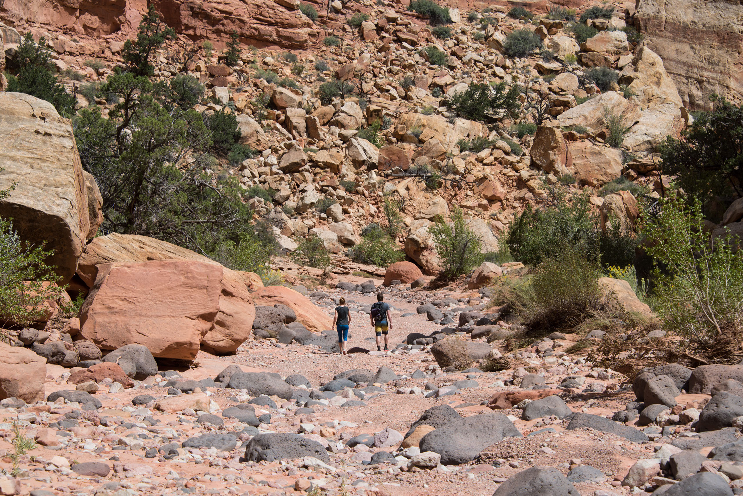
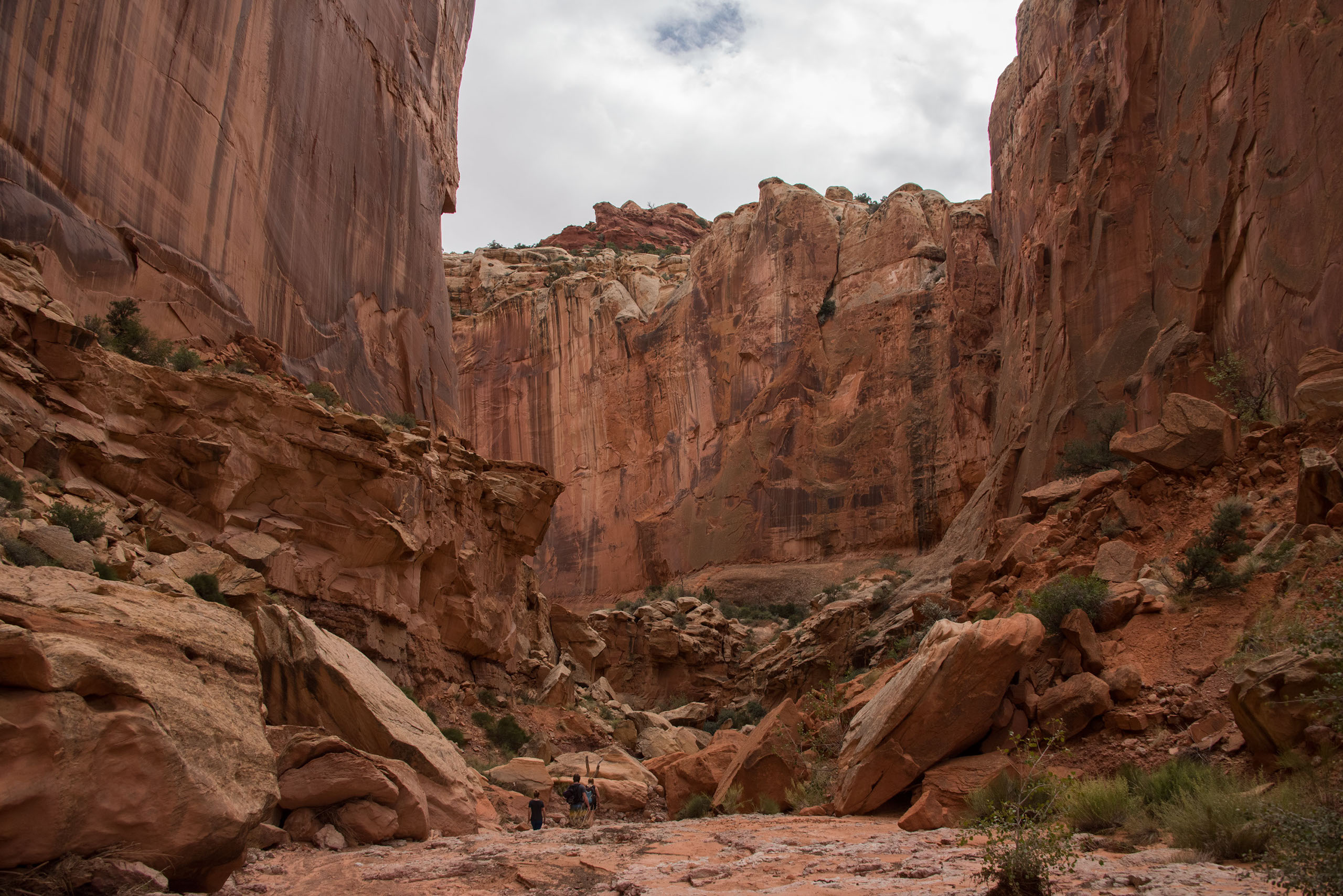
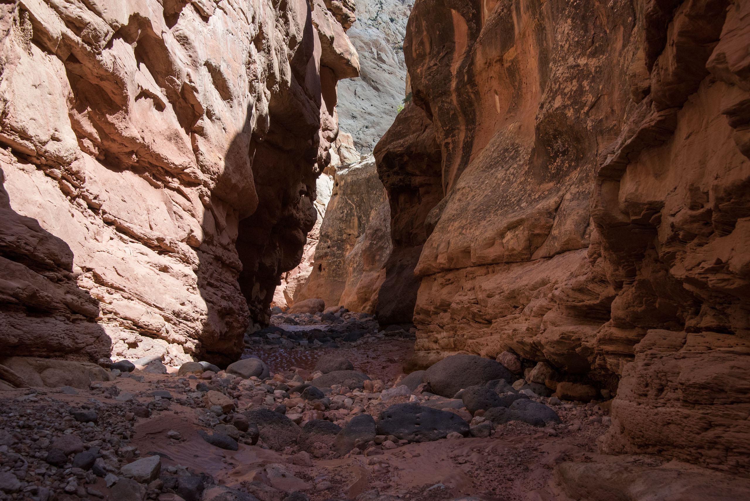
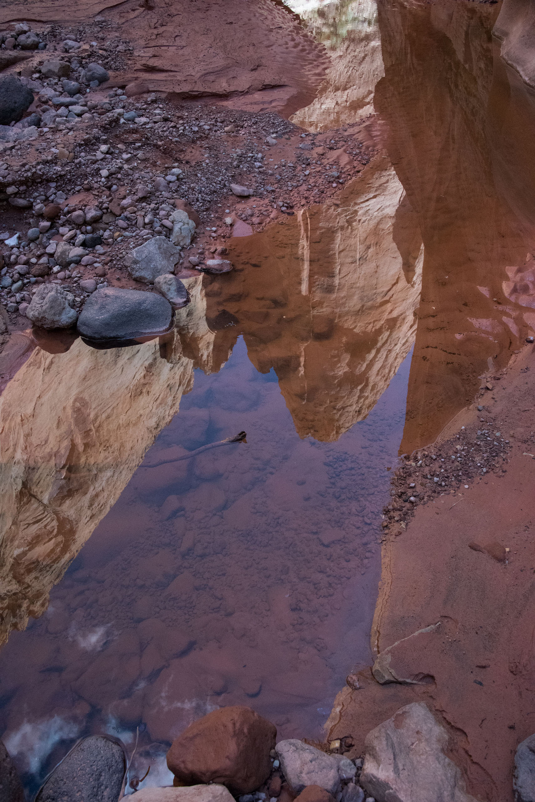
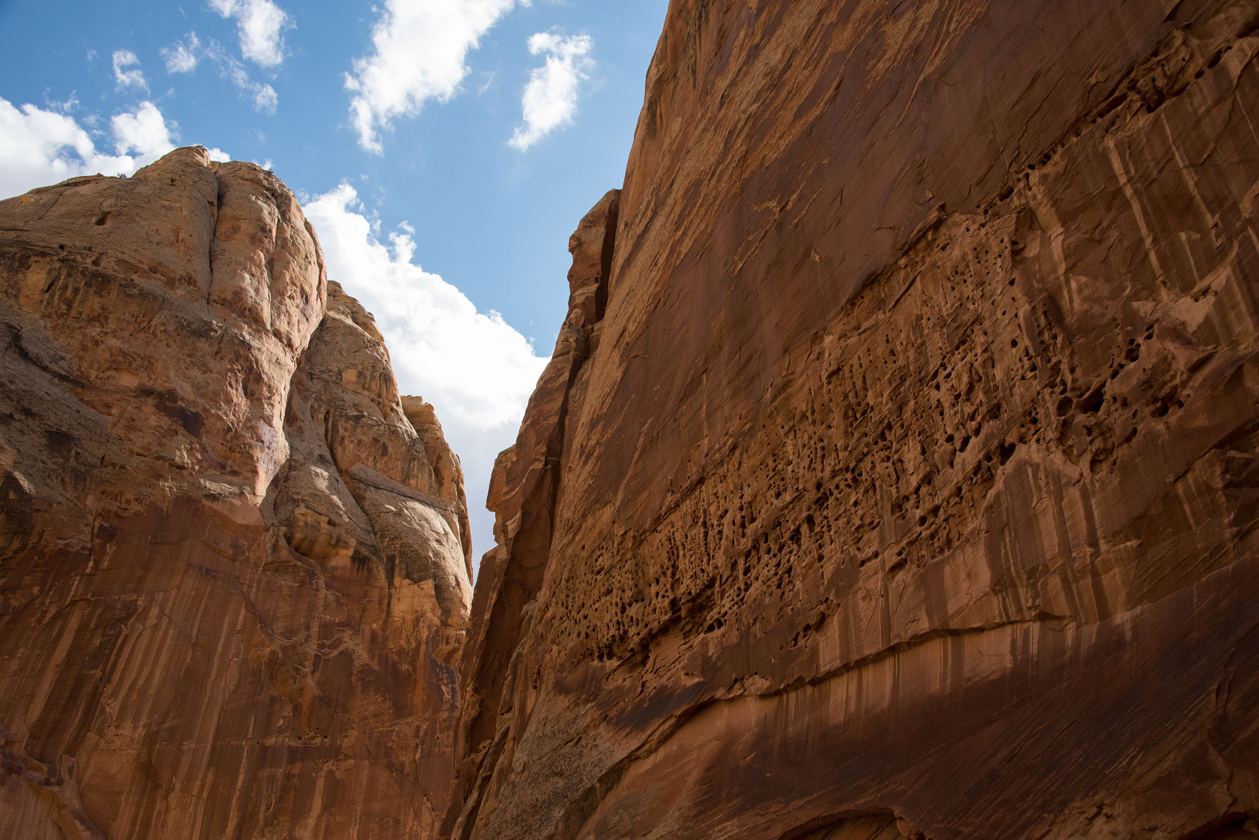
Keep in mind that Spring Canyon is not a maintained trail, but is actually a streambed. Conditions on the trail can vary wildly depending on the time of year you go. Parts of the trail can be flooded and/or extremely muddy. Be sure to wear shoes with good grip on them. There are several areas with obstacles, such as boulders and fallen logs, for you to maneuver your way around or over. For most of the hike, the canyon is wide, but there are a couple of fun slot canyons where the walls are much closer. About halfway through the canyon, we reached a steep drop that led down into an extremely deep puddle of water. Some of our group chose to lower themselves into the water and wade through it. This can be rather technical, but if you make your way down you get to enjoy a narrow section of the canyon with massive walls towering over you on either side. If you’re not too comfortable with this option, there is a trail that follows the ridge, and will eventually lead you back down to the canyon floor. There are a couple of spots within the slots that are not hard to scramble your way up to find this trail.
At the very end of the hike, to get back on to Highway 24, you will have to ford your way across the river. This ended up being a great way to cool off after a fairly strenuous 10 mile hike. Be careful, though, as it is extremely difficult to see where you are stepping and river conditions can differ throughout the year. Typically, the water hits somewhere between knee and hip.
We would recommend doing this hike in the spring or fall, as temperatures will be significantly milder at this time of year. Be sure to pack plenty of water and hydrate often throughout the hike. It’s easy to get dehydrated down there. We hope you enjoy this canyon as much as we did!
- Drive to Capitol Reef National Park (no entrance fee)
- Park a car at the pull off on mile marker 83 to use to get back to your car at the end of the hike
- The hike starts at the Chimney Rock Canyon Trailhead
- Follow the signs that direct you toward Spring Canyon
- This will guide you into the riverbed which will take you back to your car
- At one point you enter a slot canyon, you can either climb down into the canyon or follow the ridge. Both paths will link back up
Trail Length: 9.7 miles
Time: 4-5 hours
Trail Usage: Hikers, not pet friendly
Difficulty: Moderate. Although elevation gain is primarily limited to the first portion of the hike, the distance and sun exposure makes this hike a little more challenging